- From
-
Published on
10.03.25
Urbanization is a major driver of biodiversity loss worldwide, with low- to middle-income countries in the global south facing the most severe consequences. The challenge is compounded by the lack of comprehensive data and logistical difficulties such as insecurity, inaccessible roads, and expensive running costs, making biodiversity studies in these regions particularly difficult. Innovative approaches are needed to track biodiversity changes effectively and support conservation efforts.
In a recent study, scientists from IITA and University of Granada used satellite remote sensing imagery to assess avian diversity in Afrotropical urban and non-urban areas. The scientists aimed to identify the most effective spectral indicators for measuring bird taxonomic, functional, and phylogenetic diversity.
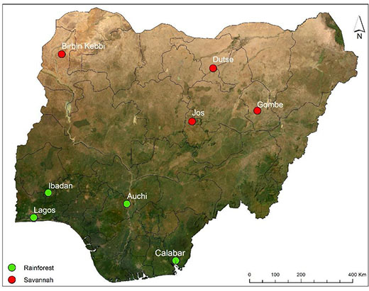
The study conducted bird sampling at 400 locations across eight sites in Nigeria, covering two vegetation zones (rainforest and savannah) and two habitat types (urban and non-urban). At each location, they extracted 29 spectral indicators within a 50-meter radius.