Capacity sharing program on integrated storage mapping using Earth Observation data and data analytics approach
-
Date
25.11.24
-
Time
09:30 am > 05:30 pm UTC+05:30
-
Registration
Invitation only

| 25 November 2024 | 09:30–17:30 | Hyderabad, India |
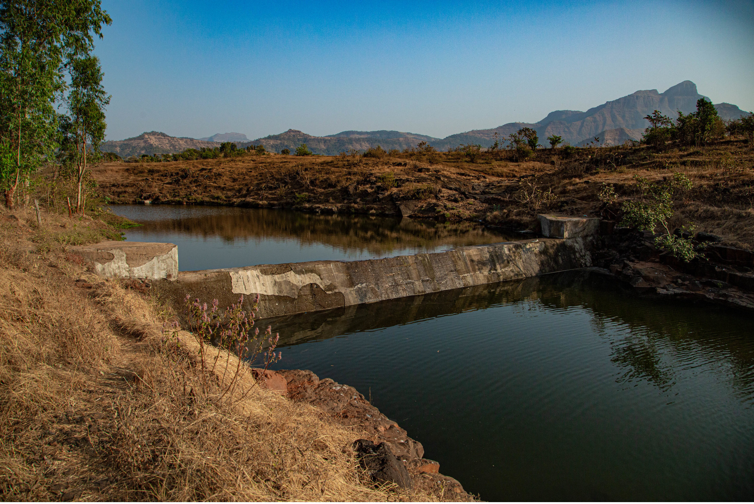
Surface water sources like rivers, lakes, and reservoirs are essential for those living alongside them for drinking, agriculture, and industry, as well as supporting natural environments. These sources also help recharge groundwater systems and act as buffers against floods and droughts. Surface water storage is a critical component of integrated water storage systems, which include surface water, soil moisture, and groundwater. Understanding the variability of surface water storage is essential for comprehensive water resource assessment. Activities, such as intensive irrigation, can significantly impact the seasonal variations of total water storage.
The International Water Management Institute (IWMI), with funding from the CGIAR Initiative on NEXUS Gains, has developed TRACE, a web-based tool that uses satellite data and field information to monitor surface water storage. TRACE allows for rapid assessment of water availability in various water bodies, from small ponds to large reservoirs. This technology enables periodic monitoring of surface water storage, providing valuable information for water resource management and planning decisions to assess the impact of climate change on water resources and to ensure long-term water security.
This training program aims to equip national partners with the knowledge and skills to use the TRACE tool for water storage assessment. Participants will gain a comprehensive understanding of how to use publicly available Earth Observation datasets on the Google Earth Engine platform to assess surface water storage. The program will introduce the innovative TRACE toolbox, designed for rapid assessment and analysis of water storage. Participants will have an opportunity to share their insights and feedback on the methodology, concepts, and toolbox, fostering collaboration and knowledge exchange.
The training program covers four modules: 1) concept on integrated storage mapping; 2) methodology and tool development; 3) case study: validation and evaluation for Ramganga Basin; and 4) discussion on the application development and scaling.
This work is being carried out under the CGIAR Initiative on NEXUS Gains, which is grateful for the support of CGIAR Trust Fund contributors: www.cgiar.org/funders

